BSR Web 2.0
  • Home
  • About The Restoration
    • Motivation
    • Methods
    • Results & Goals >
      • Overview
      • Results
      • Implications
    • Funding
  • Research
    • Monitoring >
      • Freeze-Thaw Experiments
    • Publications
    • Honors & Awards
  • Media Gallery
    • Visualizations
    • Videos
    • Photos
    • Podcasts
    • Press
  • Partners
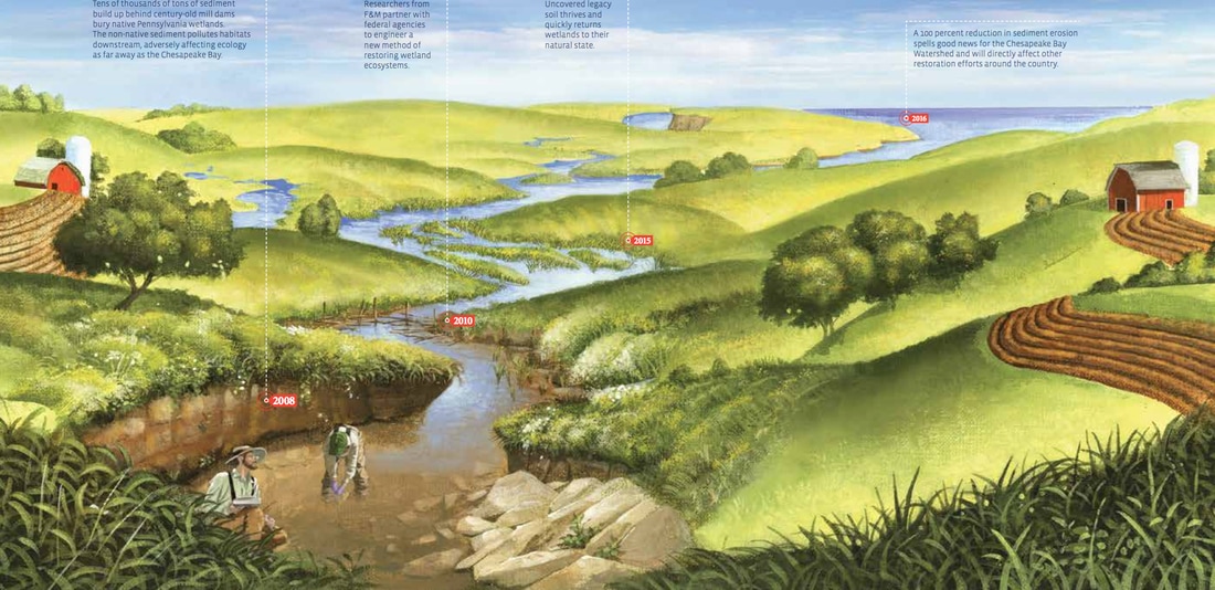
Pre-Restoration 2D Hydraulic Modeling
Post-Restoration 2D Hydraulic Modeling
Just how many mill dams were there along the east coast US? 
Click on the image to visualize 
Picture
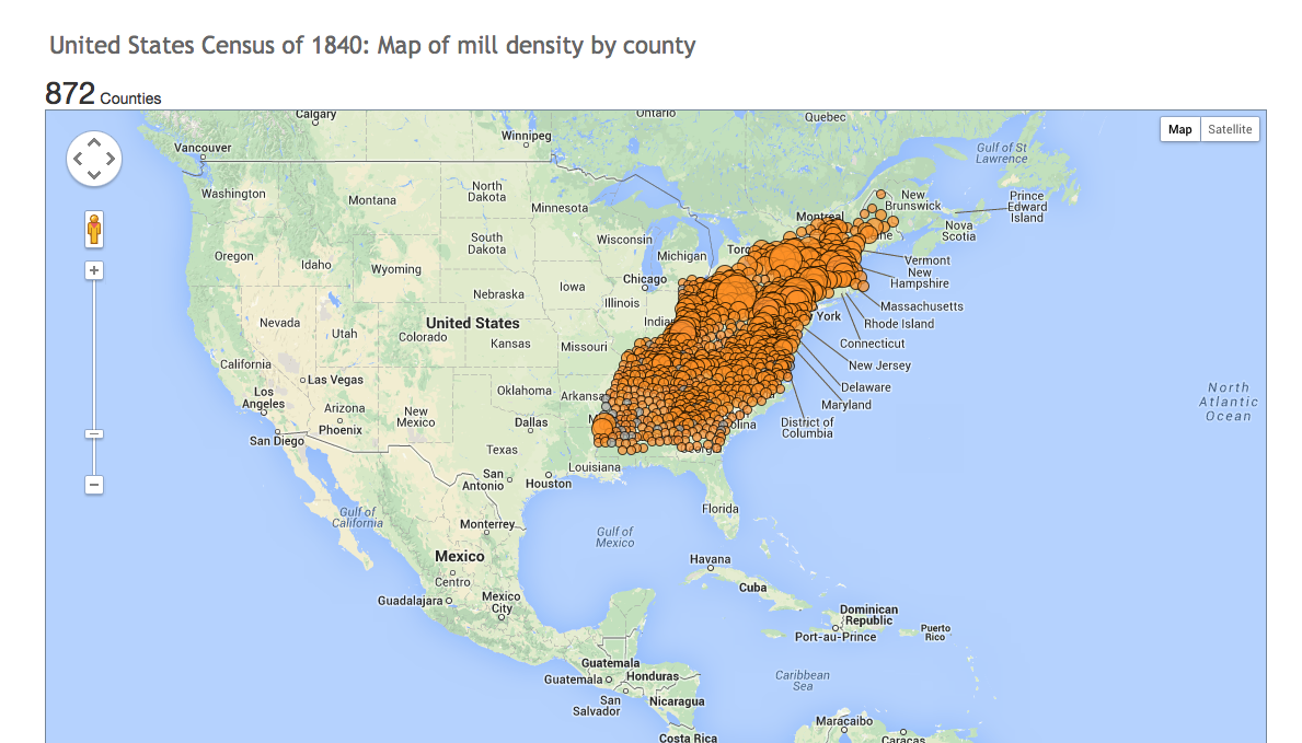
Envision what has been happening to landscapes along the east coast US over the past 10,000 years
Illustration for Franklin and Marshall College Magazine - Wetland Revival by Kristen Evans '07
Picture
Images of BSR generated using TLS ground-based LiDAR
"Bare Earth" views of BSR generated using airborne LiDAR

Click on link below to download KML layer of BSR - for Google Earth:
BSR_slopeshade_GoogleEarth.kmz
File Size: 1002 kb
File Type: kmz
Download File


Powered by Create your own unique website with customizable templates.
  • Home
  • About The Restoration
    • Motivation
    • Methods
    • Results & Goals >
      • Overview
      • Results
      • Implications
    • Funding
  • Research
    • Monitoring >
      • Freeze-Thaw Experiments
    • Publications
    • Honors & Awards
  • Media Gallery
    • Visualizations
    • Videos
    • Photos
    • Podcasts
    • Press
  • Partners